I’m lagging behind on blog posts again but last weekend we managed to get up for a short scenic HeliPro flight over Wellington for Ciara’s birthday. We had to cancel on the big day due to the typical last minute windy Wellington weather but on the Saturday the weather was superb. We departed from the waterfront in the heart of Wellington city and flew around above the city for a mere 10 minutes but it was great all the same. I love seeing things from above so it would never be a bad trip. We managed to get indoor climbing again the following day.
Unfortunately I don’t think the birthday meal was totally gluten free so the day before the flight wasn’t so great, but the upside was that we stayed in Wellington rather than going away, and managed to get the flight in. I’ll let the pictures speak for themselves (almost). Unfortunately some of them are blurred as I was too busy looking rather than thinking….arg – I’ll need to go up again! Hopefully it will give some of you at home a better idea of Wellington as well.
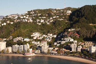
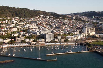
These are a downtown area called Oriental Bay – only 15 minutes walk from the main shopping street, if that. This is where we thought we’d like to stay initially but wanted to be further out of town.
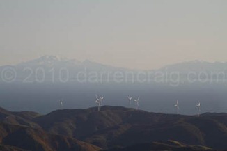
This first image is for us, probably one of the biggest frustrations of living in Wellington…. in the foreground are the hills around Wellington, and the background is the South Island. It’s probably a 20 minute drive. If you could drive on water….erm, due to that you have to take the expensive ferry which doesn’t really make it feasible for a normal weekend if you take a van with you. There’s a lot of stuff in the North of the South Island that we’d like to do in preference to heading north at weekends. As the crow flies they’re about the same distance, just more costly due to the ferry….arg…. If you had 130 mile visibility you’d pretty much see Christchurch.
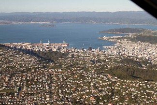 This is erm…an aerial view of Wellington. We live next to the little inlet by the green peninsula at the top right of the picture….in fact I went running along there the other morning!
As I’m talking about where we stay, we’re staying put in our friends house as they’ve been kind enough to let us stay longer term. If you want to see the general area we’re staying in, you can check out this Google satellite view below. The general area we stay around is close by the ‘A’ marker, the city centre is just off the top of the map, our favourite cafe is in Lyall Bay on the South (about 10 mins walk from us), and just off the bottom left of the image you can walk along the coast on a 4×4 track to see the seal colony. Have a scroll around or click the map to see it within Google. The photo above is pretty much taken from outside the top left of the map, looking towards the right of it, if you really want to start getting complicated!
